


Introduction to the SE FireMap
Date: April 16, 2021
Time: 1:00 PM - 2:00 PM
Time Zone: America/New_York
Contact: Southern Fire Exchange
Link to PDF
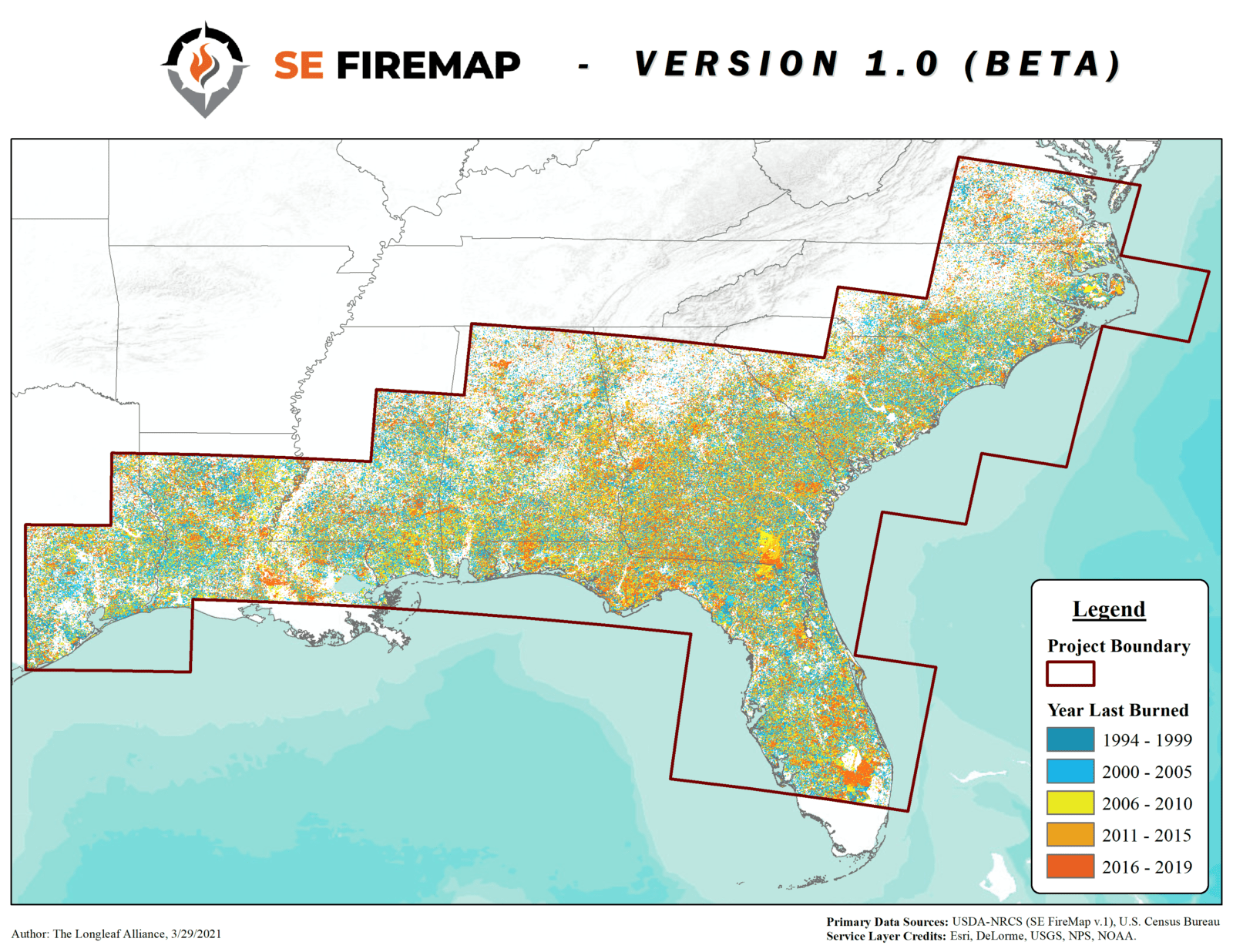
The SE FireMap is a new fire mapping system for the Southeastern United States. Developed with funding provided by the USDA Natural Resources Conservation Service, SE FireMap uses a remote sensing based approach to track both prescribed fire and wildfire activity on public and private lands across the range of the longleaf pine. This webinar will introduce the SE FireMap, describe the source of the fire data, and explore the current opportunities to use the data.
Presenters:
Bridgett Costanzo – Working Lands for Wildlife Coordinator-Eastern US, USDA Natural Resources Conservation Service
Joe Noble – Geospatial Program Director, Tall Timbers Research Station and Land Conservancy
Lucas Furman – SE FireMap Technical Oversight Team Lead, The Longleaf Alliance
*Following the presentations there will be time for audience Q&A with the speakers.
Date: April 16, 2021
Time: 1:00 PM - 2:00 PM
Time Zone: America/New_York
Contact: Southern Fire Exchange
The SE FireMap is a new fire mapping system for the Southeastern United States. Developed with funding provided by the USDA Natural Resources Conservation Service, SE FireMap uses a remote sensing based approach to track both prescribed fire and wildfire activity on public and private lands across the range of the longleaf pine. This webinar will introduce the SE FireMap, describe the source of the fire data, and explore the current opportunities to use the data.
Presenters:
Bridgett Costanzo – Working Lands for Wildlife Coordinator-Eastern US, USDA Natural Resources Conservation Service
Joe Noble – Geospatial Program Director, Tall Timbers Research Station and Land Conservancy
Lucas Furman – SE FireMap Technical Oversight Team Lead, The Longleaf Alliance
*Following the presentations there will be time for audience Q&A with the speakers.